


FILES
1. Product Description
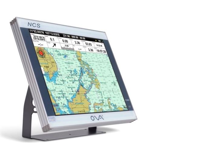
Chartplotter with 12” true color TFT LCD display could be viewable under sunlight.
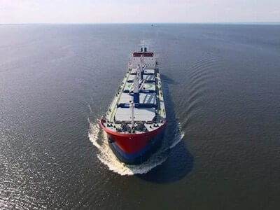
GPS plotter combine AIS target information and AIS group management.
Our AIS for small boat has the strong alarm warn system.
Specification
| Model | AIS-N12 |
| Display | 12” |
| Resolution | 800*600px |
| Voltage | DC 24V(11~35V) |
| Power | High-performance, full isolated, PWM control of power supply |
| Mount | Bracket Mount or Flush Mount |
| Power Consumption | ≤20W |
| Language | Simple Chinese, Traditional Chinese, English (Can be customized) |
| Map Format | S57, S63(ENG), CJ57, CJ63, C-Map |
| Image Format | img, tif |
| Map Display Mode | Heading Up, Course Up, Route Up, North Up, East Up, South Up, West Up |
| Ownship Data | Position, Speed, Course, Heading, Altitude, GPS Positioning Status, Present Fishing Zone |
| Navigation Data | Bearing, Present Distance, Distance to the Destination, Yaw Distance, Yaw Angle, Navigation Arrow, Sailing Time, ETA (Estimated Time of Arrival), Navigation Distance, Average Speed, Maximum Speed, Target Fishing Zone, etc. |
| Others | Time, Depth, Wind Speed, Wind Direction, Simple Compass, etc. |
| Data Display Mode | Top Display (Various Arrangement), Left Display, Right Display, Suspension Display |
| User Data | ≥50000 waypoints, 200 routes, 10000 waypoints per route. 20000 tracks, 500 tracks per AIS. Plot data(point, line, plane) |
| SD Card | Update Software, chart data import and export |
| AIS Functions | AIS Display, AIS Message, AIS Log, AIS Fleet Management, AIS Fishing Net Management, AIS Special Vessel Management. etc. |
| System Alarm | Loss Alarm, Time Alarm, Low Voltage Alarm, High Voltage Alarm, No Positioning Alarm, Positioning Accuracy Alarm |
| Navigational Alarm | Yaw Alarm, Arrival Alarm, Anchor Drag Alarm, Bridge Alarm, Danger Alarm, Precautionary Area Alarm, etc. |
| Other Functions | Measuring Distance, Compass Superposition, Eccentric Setting, Calendar, Harbor, Tide, Odometer, Navigational Log, Find the Map according to Longitude and latitude, etc. |
| GNSS Performance | Customized Positioning Source(GPS, Beidou, Glonass, Galileo) |
| Receiving Type | GPS, Beidou, Glonass, Galileo |
| Receiving Channel | GPS:1575.42MHz Beidou:1561.098MHz |
| Positioning Time | Cold Start:45s
Hot Start:15s |
| Positioning Accuracy | GPS:<15m (95%)
Beidou: Horizontal 25m (95%) Vertical: 30m (95%) |
| Input(NMEA0183) | GPS, AIS, Compass, Depth, Water Temperature, etc. |
| Output(NMEA0183) | GPS: GGA, GLL, GSA, GSV, RMC, VTG, ZDA |
| Navigation | AAM, APB, BOD, BWC, BWR, RMB, RTE, WPL, XTE |
| Sonar | DBT, DPT, MTW, VLW, VHW |
| USB | Software Upgrade; Can be connected with Mouse, Keyboard; User data import and export |
| Frequency | AIS 1: 87B/161.975MHz
AIS 2: 88B/162.025MHz |
| Bandwidth | 25KHz |
| Output Power | 2W |
| Modulation Mode | GMSK |