


FILES
Product Description
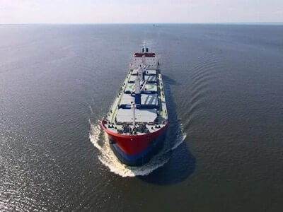
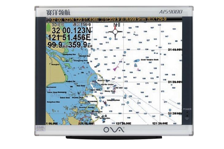
Marine GPS plotter AIS9000-L190 19″ with built-in AIS is supplied by Saiyang.
We are manufacturer and developed in AIS marine navigation for 14 years.
Product Specification
| Model | AIS9000-L190 | |
| Display Size | 19″ | |
| Resolution | 1024×768 | |
| ExternalDimension | 442mmx362mmx100mm | |
| Display Mode | TFT LCD COLOR Display | |
| Operating Mode | Infrared remote control | |
| Language | Simple Chinese, English, Traditional Chinese | |
| Voltage Range | 11~35V DC | |
| Power | High performance, full isolated PWM control of power supply | |
| Power Dissipation | ≤30W | |
| Safe Distance of Compass | ≥1.5m | |
|
AIS Function |
TX Channel | 1 ch |
| RX Channel | 2 ch | |
| RF Out Power | 2W | |
| Receive Frequency | 156.025~162.025MHz | |
| Default Channel | CH2087,CH2088 | |
| Bandwidth | 25KHz | |
| Modulation Mode | GMSK | |
| Receive
Sensitivity |
Superior to-107dBm | |
| TX Channel | 87B/161.975MHz | |
| RX Channel | 88B/162.025MHz | |
|
GPS Receiver |
Adopt high speed stable technology | |
| GPS positioning accuracy:≤15m, 95% accuracy | ||
| Positioning time:cold start 45s, warm start 15s | ||
|
Navigation Performance |
Waypoints:6000 points | |
| Marks:5000 points | ||
| Route:200 routes,each route contains 48 waypoints | ||
| Track:≥200 routes | ||
| Include the tide and compass | ||
| Intelligent collision avoidance | ||
|
Interface |
1.GPS output:RS-422, NMEA0183, 4800bps | |
| 2.AIS input & output:RS-422, NMEA0183, 38400bps | ||
| 3.Sonar input & output:RS-422, NMEA0183, 115200bps | ||
| 4.GPS Antenna Interface:BNC base, impedence 50Ω | ||
| 5.VHF Antenna Interface:UHF base, impedence 50Ω | ||
| 6.Powerinterface: 24V DC(11~35V DC) | ||
| Environment | Temperature | -15℃~50℃ |
| Protection Level | IP44 | |
|
Standard Annex
|
1. GPS Antenna | |
| 2. Power Line | ||
| 3. Safety Fuse, Locking Screws | ||
| 4. Manual, Certificate, Warranty Card | ||