


FILES
Product Description
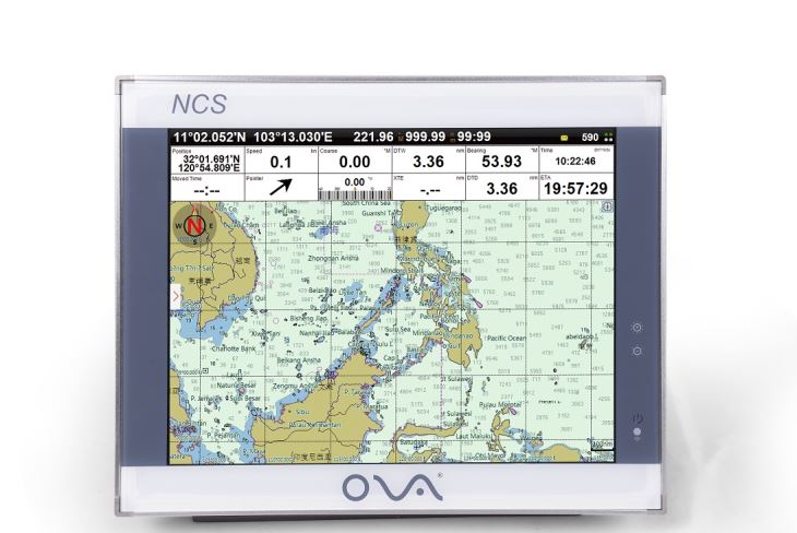
Multifunction GPS navigator with 15 inch display is made by Nantong Saiyang Electronics CO., Ltd which has image maps,electronic chart and AIS target information.
Big screen gives you good visual effects and make you see more clearly.
Specification
| Model | NCS-15 |
| Voltage | DC 24V(11-35V) |
| Bandwidth | 25KHz |
| Resolution | 1024*768px |
| Frequency | 161.975~162.025MHz |
| Power Consumption | ≤20W |
| Installation | Bracket or flush |
| User Data | 50000 waypoints,200 routes,10000 waypoints per route.20000 tracks,500 tracks per AIS |
| Navigation Data | Bearing,present distance,distance to the destination, yaw distance,yaw angle,navigation arrow,sailing time,ETA(estimated time of arrival),navigation distance,average speed,maximum speed,target fishing zone,etc. |
| Own Ship Data | Position,speed,course,heading,altitude,present fishing
zone,GPS positioning mode |
| Power | High-performance,full isolated,PWM control |
| Language | Simple Chinese,Traditional Chinese,English (Can be customized) |
| GPS Performance | Adopting advanced technology of high stable navigational speed and course |
| System Alarm | Loss Alarm, Time Alarm, Low Voltage Alarm, High Voltage Alarm, No Positioning Alarm, Positioning Accuracy
Alarm |
| Navigational Alarm | Yaw Alarm, Arrival Alarm, Anchor Drag Alarm, Bridge
Alarm, Danger Alarm, Precautionary Area Alarm, etc. |
| Other Functions | Measuring Distance, Compass Superposition, Eccentric Setting, Calendar, Harbor, Tide, Odometer, Navigational Log, Find the Map according to Longitude and latitude, etc. |
| SD Card | Update Software, chart data import and export |
| Input(NMEA0183) | GPS, AIS, Compass, Depth, Water Temperature, etc. |
| Output(NMEA0183) | GPS: GGA, GLL, GSA, GSV, RMC, VTG, ZDA |
| Navigation | AAM, APB, BOD, BWC, BWR, RMB, RTE, WPL, XTE |
| Sonar | DBT, DPT, MTW, VLW, VHW |
| USB | Software Upgrade; Can be connected with Mouse, Keyboard; User data import and export |