


FILES
Product Description
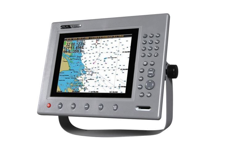
Satelite marine AIS navigator is built-in map and has AIS receive and transmit function.
The AIS chartplotter AIS9000-10 is 10inch for boat with strong alarm warn system.
Product Parameters
| Model | AIS9000-10 |
| Power Supply | DC 24V (11~35V) |
| Power | High-performance, full isolated, PWM control of power supply |
| Installation | Desk or Hanging Installation |
| VHF Transceiver | |
| Frequency Range | 156.025 MHz~162.025 MHz |
| Channel Bandwidth | 25KHz |
| Modulation | GMSK |
| Number of Transmitters | 1 |
| AIS Channel 1 | CH 87B (161.975MHz) |
| AIS Channel 2 | CH 88B(162.025MHz) |
| Tx Power Output | 2 Watt(33dBm ±1.5dBm) |
| Rx Sensitivity | <-107 dBm @ 20% PER |
| Rx Message | AIS Class A & B messages |
| GPS Receiver(Built-in) | |
| Receiving Channels | 50 channels(Customizable GPS+Beidou) |
| Acquisition Time | Cold Start: 45s Hot Start: 15s |
| Accuracy | <15m (95%) |
| LED INDICATION | |
| Power(Red) | System Power on/off |
| Error(Yellow) | Receiving or transmitting error |
| TX(Red) | Transmitting AIS Data |
| RX1(Green) | Receiving AIS channel 1 data |
| RX2(Green) | Receiving AIS channel 2 data |
| GPS(Green) | Receiving GPS data |
| Interface | |
| GPS Antenna Connector | BNC |
| VHF Antenna Connector | NS-KYA3 |
| NMEA0183(RS-422) | 1(38400bps) |
| Environment | |
| Input/Output | -15°C~55°C(+5°F~+130°F) |
| Waterproof | IP44 |
| Applicable Standards | |
| IEC 62287-1 Ed.2, 2010 IEC 61108-1 Ed.1, 2003 IEC 61162-1 Ed. 3, 2007 | |
| IEC 60945 Ed. 4, 2002 IEC 61162-2 Ed. 1, 1998 ITU-R M.1371-4, 2010 | |