


FILES
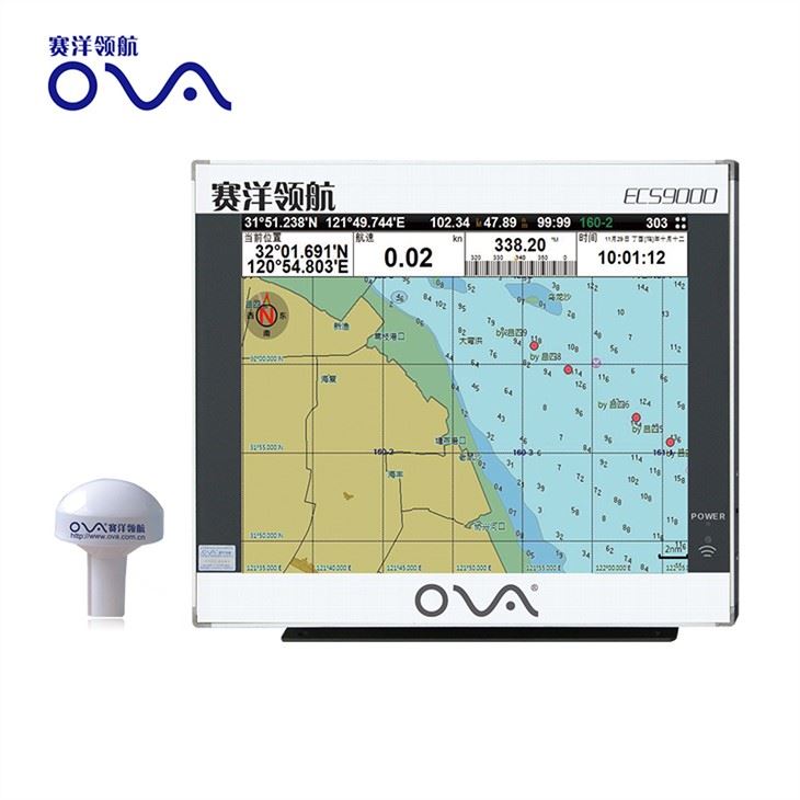
GPS marine navigation with chartplotter, 17 Inch Dual System Marine Electronics Chart Plotter System
Product performance
●The electronic sea map is including global map, supporting vector map IHO,S57,S63 and RNC raster sea chart
●Flexible expandability and many navigation sensor interfaces allow the ECS to be networked with AIS,GPS,Echo Sounder,Compass,Log,ARPA and others to consolidate the navigation system
●17 inch industrial display screen provides high resolution of 1280×1024
●The electronic chart can be overlaid with a variety of navigation data such as ship’s position, heading,speed and others to facilitate safe and efficient navigation
●Navigation data for the past 12 hours can be recorded and playback
●CERTIFICATED by China Classification Society
●CERTIFICATED by Register of Fishing Vessel of The People’s Republic of China
Technical Specification:
|
Model
|
ECS9000
|
 |
|
|
Power Supply
|
DC24V(16-35V)
|
|
Power
|
High-performance, full isolated, PWM control of power supply
|
|
Installation
|
Desk,Bracket or Embedded
|
|
Display Unit
|
|
|
Type
|
17”
|
|
Screen Resolution
|
1280*1024px
|
|
Language
|
Simplified Chinese, English
|
|
Characteristics
|
|
|
Chart Format
|
IHO S57,S63(ENC),RNC
|
|
Display Modes
|
North-Up、SouthUp、Route-Up、Head-Up
|
|
Display of Data
|
Own ship:Position,COG,SOG,Heading;
Others:Cursor Data、Target information、Navigation、EBL、VRM |
|
Route/Waypoint
|
Routes≥100;Waypoints≥5000
|
|
Alarm
|
Off track,Communication,Position,Collision,Alert area,Hazardous material
|
|
Voyage Calculation
|
Range/Bearing to Destination,Off track,TTG,ETA
|
|
Navigation Log
|
≥12h
|
|
Track Display
|
≥240min
|
|
Other Functions
|
Measurement(Distance,Bearing,CPA/TCPA),User chart function,Log book,Night/day presentation colors,ARPA target display
|
|
Interface
|
|
|
Input/Output
|
GPS(GGA,GLL,GSA,GSV,RMC,VTG)
|
|
Input
|
AIS(VDM,ABM,BBM),compass(HDT),Speed log(VBM),
Echo Sounder(DBT,DPT),Water temp Indicator(MTW), Anemometer(MWV),Current Indicator(VDR) |