


FILES
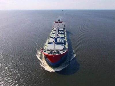
An ECDIS system displays the information from electronic navigational charts (ENC) and integrates position information from the Global Navigation Satellite System (GNSS), gyrocompass, speed log, other navigational sensors, radar and automatic identification systems (AIS). Transas delivers a full range of type-approved ECDIS solutions that can be stand-alone or part of the Integrated Navigation Systems or Multifunctional Display i.e. Radar, Conning, Bridge Alarm Management, Track Control in one workstation. Transas ECDIS provides easy and unique possibilities for customization.
Each system includes a carefully selected range of standard features, with an extensive range of additional hardware and software options. So whether you’re just beginning your ECDIS journey or seek the ultimate level of information at your fingertips, Transas offers something for every
Advantages
- The world’s number one ECDIS
- User-friendly navigation tool
- Most evolved ECDIS on the market
- Flexible configuration
- MFD functionality and network capability
- Consistent graphic user interface (GUI)
Two solutions for different customer needs:
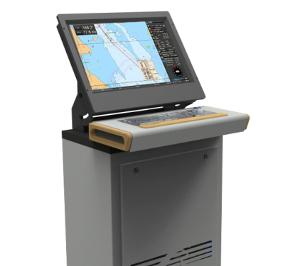
ECDIS Premium
- High-performance ECDIS solution
- Based on a high-performance RS6B computer and dedicated displays
- Fully compliant to the latest ECDIS regulations
- Dual (paperless) or single workstation available
- Fixed commissioning fee available
- Ready for all Transas data products
ECDIS Standard
- Entry ECDIS system
- Based on a panel PC
- Fully compliant to the latest ECDIS regulations
- Dual (paperless) or single workstation available
- Fixed commissioning fee available
- Ready for all Transas data products
| ECDIS Premium | All mandatory ECDIS functions |
| Intuitive user interface with 5 different layouts (skins) | |
| Configurations for quick restore of user-defined settings | |
| Comprehensive route planning tools, preparation of voyage plan route | |
| Route exchange in several industry formats including the new RTZ format | |
| Split-screen (vertical or horizontal) with independent scale or area of interest | |
| Conning window inside panel | |
| Tides & Currents, Maps (User Charts), Playback | |
| AIS messaging | |
| Advanced Planning | |
| Admiralty Information Overlay (AIO) Charts | |
| Add Info Tracks | |
| Precise Navigation Tools – Trial Maneuvering/ Predictor/ Route Rendezvous/ Curved Headline | |
| User Ship Contour | |
| Radar overlay Software (require RIB6 HW option) | |
| Electronic Logbook one-year subscription included | |
| ECDIS Standard | All mandatory ECDIS functions |
| Intuitive user interface with 5 different layouts (skins) | |
| Configurations for quick restore of user-defined settings | |
| Comprehensive route planning tools, preparation of voyage plan route | |
| Route exchange in several industry formats including the new RTZ format | |
| Split-screen (vertical or horizontal) with independent scale or area of interest | |
| Conning window inside panel | |
| Tides & Currents, Maps (User Charts), Playback | |
| AIS messaging and MKD functions | |
| Advanced Planning | |
| Admiralty Information Overlay (AIO) Charts | |
| Add Info Tracks |